Flooding in America
Guests

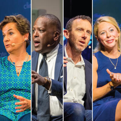
Julia Kumari Drapkin
Ed Kearns
Martha Shulski
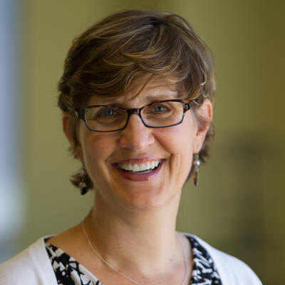
Betsy Otto
Summary
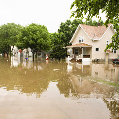
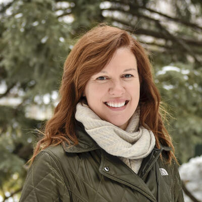
“We had one of the snowiest winters on record in Lincoln and Omaha,” reports Martha Shulski of the Nebraska Climate Office. She’s describing the weather conditions and events that led to what has become known as the “Great Flood of 2019.”
“2019 was actually one of the wettest years on record for the upper Midwest,” Shulski continues. “Snowpack sitting on the ground, lots of ice in the rivers. So the conditions were ripe such that when we did get that strong storm system move across the country...the setup was there.”
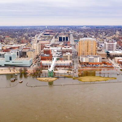
The Missouri River and its tributaries swelled above their banks throughout Nebraska, Missouri, South Dakota, Iowa and Kansas, setting record levels in 42 locations. Over a million acres of farmland were flooded, and the cost of damages and emergency response mounted into the billions.
One lesson that could be taken away from that disaster is that our aging dams and levees were woefully unprepared for such vast amounts of water. And climatologists predict that there’s more climate-related precipitation to come. Is America’s infrastructure ready for the next Great Flood?
“It’s absolutely going to fail for future climate events,” Shulski warns. “If you're not planning for the climate of 2040 or 2060 then there's going to be failure. There's going to be impacts in a very extreme way perhaps.”
Tracking floods, hurricanes and other volatile weather events in order to prevent future destruction may seem like the province of data scientists and weather nerds. But those with a stake in planning next season’s harvest have been doing this work for generations.
“When you ask a rancher or farmer how they make year to year decisions, they will go and bring out a notebook with all the detailed notes about weather and climate on their farm or ranch,” says Julia Kumari Drapkin. After 15 years as a climate reporter, Kumari Drapkin noticed “the disconnect between people’s every day daily experiences and what the climate models were telling folks.”
Kumari Drapkin created ISeeChange, a website that allows people to contribute observations about climate change in their communities, “to kind of create a mechanism for people’s every day experiences to inform models and vice versa.”
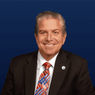
Ed Kearns is a data scientist with First Street Foundation, which maps flood risk throughout the country.
“Most neighborhoods today may not be aware of what their flood risk is; most of them aren’t aware of the adaptations that surround them,” Kearns says. “By making the flood risk information available to everyone freely we’re hoping to level that playing field.”
Betsy Otto, Global Water Director at the World Resources Institute, studies what happens on the other end of the spectrum: when there isn’t enough water to sustain people or crops. “Water is essential to all life and yet we underprice it,” says Otto. “In part because we see it as a human right. But unfortunately that means we then allow it to be used for any purpose at an extremely low or no cost.”
Additional interview:
Jack Mulliken, farmer in Northeast Nebraska
Related Links:
ISeeChange.org
First Street Foundation
Find your home’s flood factor
The Great Flood of 2019: NY Times Interactive Map
Climate Data Online (NOAA)
World Resources Institute: Water
This program was recorded on July 28 and August 4, 2020, and is generously underwritten by the Water Foundation.
Full Transcript
Greg Dalton: This is Climate One. I’m Greg Dalton. On today’s program - lessons from the Great Flood of 2019.
Martha Shulski: We had one of the snowiest winters on record in Lincoln and Omaha. 2019 was actually one of the wettest years on record for the upper Midwest. Snowpack sitting on the ground, lots of ice in the rivers. So the conditions were ripe such that when we did get that strong storm system move across the country...the setup was there. [:18]
Greg Dalton: Those conditions led to catastrophic flooding along the Missouri and Mississippi rivers throughout the year. Decades-old dams and levees contributed to the devastation - over a million acres of farmland destroyed, billions of dollars in damage. What does this mean for America’s crumbling infrastructure?
Martha Shulski: If it's going to fail for current climate events, It’s absolutely going to fail for future climate events. [:06]
Greg Dalton: Flooding in America. Up next on Climate One.
---
Greg Dalton: Is America ready for the next Great Flood?
Climate One conversations feature energy companies and environmentalists, Republicans and Democrats, the exciting and the scary aspects of the climate challenge. I’m Greg Dalton.
Greg Dalton: Rising seas and hurricanes along the coasts tend to make the splashiest headlines. But last year, the midwest and southeast states grappled with torrential rains and flooding that ruined crops and caused billions in damages. And according to climatologists, there’s more where that came from.
Martha Shulski: We can only expect it to get wetter, more extreme precipitation events...if you're not planning for the climate of 2040 or 2060 then there's going to be failure. [:11]
Greg Dalton: Tracking floods, hurricanes and other volatile weather events in order to prevent future destruction, may seem like the province of data scientists and weather nerds. But those with a stake in planning next season’s harvest have been doing this work for generations.
Julia Kumari Drapkin: When you ask a rancher or farmer how they make year to year decisions, they will go and bring out a notebook with all the detailed notes about weather and climate on their farm or ranch. [:10]
Greg Dalton: On today’s program, we’ll talk about how both data science and lived experience can help us prepare for too much water. Later, we’ll look at the other extreme, when epic droughts cause people to move from their homes because crops fail and taps run dry. This program is generously underwritten by the Water Foundation.
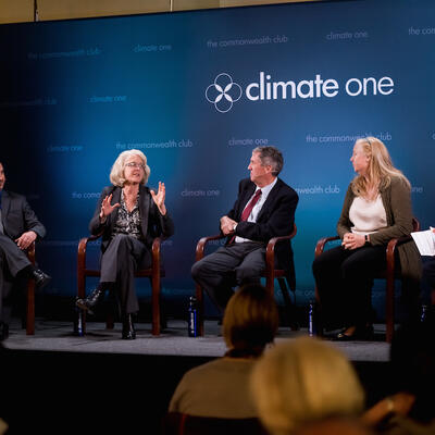
Joining me now are Martha Shulski, Director of the Nebraska State Climate Office, Ed Kearns,Chief Data Officer for First Street Foundation, which is mapping flood risk around the country. And Julia Kumari Drapkin,CEO of ISeeChange dot org. Drapkin created ISee Change after spending more than a decade reporting on natural disasters and climate change. She herself experienced an extreme and unexpected weather event first hand while growing up on Florida’s gulf coast.
PROGRAM PART 1
Julia Kumari Drapkin: I woke up in the middle of the night and we came downstairs and the Gulf of Mexico is in our living room, an unannounced guest. And I was 12 and the idea that we could have such a catastrophic flood event without any warning was shocking.
I created ISeeChange though, after many events memorably like I spent 15 years as a climate science reporter and saw the disconnect between people’s every day daily experiences and what the climate models were telling folks. And the disconnect both in terms of how people were experiencing events and their inability to relate it to the bigger picture data as well as the bigger picture data often being wrong about their experiences in real time. And so feeling the need to kind of create a mechanism for people’s every day experiences to inform models and vice versa we created ISeeChange which gathers and mobilizes community stories and micro data about climate impacts in real time. So I do wonder what would have been like if I had ISeeChange when I was 12 to talk about those events the no-name storm of 1993 which I think a lot of people on the West Coast of Florida will always remember.
Greg Dalton: Ed Kearns you grew up in Miami. Tell me about your early relationship with water and how that relates to the relationship now with water in Miami.
Ed Kearns: Yeah, I did grow up in Miami, Florida and grew up fishing in Biscayne Bay and in Florida Bay. And I love physics and the ocean and ended up pursuing a career in physical oceanography which has been tremendously rewarding. And after doing all sorts of different kinds of research I got the chance to come back to Florida to be a Professor at University of Miami. And then after that, worked at National Park Service in the Everglades working on the Everglades restoration project there. And just in the time between growing up there and coming back and working there, you know, to me it was obvious to see the sea level had changed there in Florida. But yeah, it is a gradual change but if you are used to being in the environment and fishing at shorelines in particular, you just can’t miss it.
But then part of the Comprehensive Everglades Restoration Program of course the focus on water and water budget and where water is where it isn’t and the timing of all that water. These are also things that we need to bring into the planning process and that was one of the things that really in that project and working with the government to try to figure out how to incorporate climate change into that restoration effort was one of the things that really brought climate change and water together.
Greg Dalton: Martha Shulski, the floods of 2019 were historic and unprecedented. Tell us about the scale and impact for people who didn't experience them or may have forgotten that they happened, 2019 was really an epic year in flooding particularly in the Midwest.
Martha Shulski: Yeah it sure was Greg, it was a record-setting year and timing was everything with this particular event. And I’m from Nebraska originally and I’ve lived out here different times in my life and we all know that we do have wild weather in the Midwest and things like this do happen. But the scale of 2019 was just epic. And what led to it, the antecedent conditions, the conditions in place when the storm did come along, that had a lot to do with the scale of the impact. We had a cold overall and wet winter. We had one of the snowiest winters on record in Lincoln and Omaha, frozen soils, saturated soils. 2019 was actually one of the wettest years on record for the upper Midwest. And snowpack sitting on the ground, lots of ice in the rivers.
So the conditions were ripe such that when we did get that strong storm system move across the country, which is not so uncommon to have a storm of that proportion, but the setup was there. And to have that rapid snowmelt we’re just not able to handle the water at one time that it did come. And so the spatial and temporal scale of this was quite large.
Greg Dalton: That period was January to May of 2019 was the wettest on record in the United States, causing floods as you described. One of the farmers whose livelihood was threatened is Jack Mulliken, who lives in Northeast Nebraska just outside the town of Nickerson. He farms, corn, soybeans and this year as he tried to recover even a little bit of hemp. We asked him to talk about what happened and what he thinks can be done to protect farms like his in the future.
[Start Playback]
Jack Mulliken: About half our land is in rolling up land so the flooding usually doesn’t involve that but the rest of us down the Elkhorn River Valley bottom and the Platte river bottom. We had a lot of snowfall in February and then about the middle of March, 13th of March to be exact, we had a 70° day. Everything started to melt. This hillside is full of terraces and of course they’re full of snow so the water just went right over the terraces and I went out and started cleaning them out with a loader and try to stop it but it was too late. We had 600 acres we couldn’t plant because it was just totally devastated. It’s taken until this spring to get things finished. It's just been very difficult.
I don't think you need any big flood control measures taken. The chance of an event like that happening again I think is pretty rare. I don’t believe it’s man-made climate change, it's just the way things are. You just have to adapt to it. And that’s the way we live out here, we just deal with whatever comes at us. The big thing is like on the Missouri River we have all those dams up and down that river. And the Army Corps of Engineers needs to rewrite their playbook on that a little bit because we get into the problem with environmentalists lying to keep a certain amount of water in these dams so to protect these fish and these birds and the snails and whatever else they’re worried about. And then when something like this happens, it's out of the Corps hands. They can’t release the water over the winter when they need to, to prepare for this snowmelt in the spring. They put those dams in to help with flood control. Well now it's turned into recreation and environmental issues. I don't know how to fix that because it’s such a powerful political movement. I don't know who can get in the way of it and turn it around.
---
Greg Dalton: That was Jack Mulliken a farmer who lives outside Nickerson, Nebraska. Julia Kumari Drapkin, if you ran into a chance to meet Jack Mulliken, what would you say to him?
Julia Kumari Drapkin: Oh, I would sit down with a coffee with Jack and talk. One of the things that I think when it comes to understanding flood risk or climate risk what it requires is time. Iterative dialogue over time and deep listening. Deep listening amongst all stake holders. Farmers, fishermen, the people that we associate potentially in kind of the way that we have paritied the climate conversation. We say, oh they are climate deniers, they don’t believe in science. A farmer or a fisherman knows more science than any climate modelers sitting in front of their computer who hasn’t been outside in a long time can. The idea of it that farmers and ranchers don’t understand what’s happening in the environment is completely and totally flawed. It’s the lens in which they are seeing and understanding those changes and the way it’s been politicized.
So if there was an opportunity to sit down with him as well as some of the members of the Army Corps who are doing flood control, we can have a really great conversation and understand the different, the math and the calculations going into a lot of these decisions. And that’s why we’ve created ISeeChange which is its own social media platform for communities to gather their stories and their data so that they can have their own evidence of how change is happening year to year so it’s much more legible. And we actually developed that from ranchers in Colorado who don’t believe in climate change. Because when you ask a rancher or farmer how they make year to year decisions, they will go and bring out a notebook with all the detailed notes about weather and climate on their farm or ranch. And when you sync that to a much more community pool of knowledge wherein potentially someone from the Army Corps who’s talking about a water level controls can actually converse, you know, talk about what their concerns are for that particular year. Then you have a deeper empathy and understanding and more nuanced understanding of year to year risks.
Greg Dalton: Martha Shulski, you go around and talk to farmers and Rotary clubs in Oklahoma. So how do you have these hard conversations with people that are in a very different place coming from perhaps the lived experience that they had that maybe not quite the same as an academic scientist?
Martha Shulski: Oh I think how you frame it and how you talk about it makes a big difference. And the content doesn’t necessarily have to be different but how it is presented does make a difference. So I tend to do my research and do background and understand about the group that I’m talking to and frame the message such that they do care about it, you know. What does that group care about? Let's connect those dots to climate change, because climate touches everything it touches all of us.
And in some cases maybe you don’t even talk about climate change. So this person maybe you talk about risk management and profitability and decreasing soil erosion and making sure their farm ground is up out of the river bottom so that’s less likely to be vulnerable to these large-scale flooding events.
So in certain settings there are angles that you can take that is not controversial like your health, like extreme weather events. I can't feel that average temperatures in Nebraska have warmed about a degree and a half. But what I can feel is the number of 90 degree days are going up or those dewpoint temperatures are going up or we got a lot of heavy rainfall recently. And I try and remind people that weather events that’s how climate change is manifested. So those are the ways that you make it tangible and local and relevant.
Greg Dalton: Ed Kearns, how many Americans are facing the risk of floods driven by human caused climate change and don't realize it?
Ed Kearns: Unfortunately, too many. And so from the First Street Foundation viewpoint so our foundation was created to communicate this climate change risk. And we picked flood for the first risk to consider because it's the most expensive, most pervasive across our country. And so one of our challenges was to do a current risk assessment for today to see, you know, let everybody know what the risk is today and what it's gonna be in the future.
So I kind of equate it to walking into the middle of the movie, right, and so climate change is the movie. So the first thing we have to try to convey to folks is what's going on what’s the plot how do we get here? And then we’re gonna tell them about where this movie is going where the plot is gonna go and how the movie is gonna end. And so taking a communication approach that’s focused on the individual to try to make all this complexity of climate change climate models and hydraulic models and storm surge and all these different kinds of flooding that are combined for a total flood risk to try to get that information down to a consumable level for the individual is a challenge.
And at first what we try to do is boil all that information down all that risk assessment down into one number between 1 and 10. One being minimal risk, 10 being extreme risk. And to let the individual property owners so our, the First Street Foundation flood model has created a flood risk assessment for every single one of the 142 million properties in the contiguous U.S. today. And we’re targeting through flood factor.com that individual that needs to understand at their property at their home what’s the risk today and what it’s gonna be in 30 years. And boil that down, that cumulative risk and severity down to a single number. The idea is to wake them up to this reality and then urge them and point them to resources where they can find out more about their local community, their local situation, their local flood risk and really start to understand it. And then take steps to mitigate that risk
Greg Dalton: Julia Kumari Drapkin what do you think about the First Street model you think you have questions or concerns about its accuracy or what’s under the hood?
Julia Kumari Drapkin: Oh always, I always wanna look under the hood of a model. Because when you sit with a modeler and you sit with ISeeChange data you add granularity and what I mean by that is you add details that allow the model, you know, models make assumptions about risk and they’re averaging large amounts of time and space and intersections and they can’t always really account for your true risk.
And so what we, our approach to modeling whether its flood modeling or heat modeling or climate modeling is to take community knowledge about those particular places paired with observation over time about impact. And then compare it to the model and integrate it with the model to validate it. We call it validation, model validation. In some places FEMA has like New Orleans or Miami spent more time because of repeat loss. And so there’s a little bit more of mapping in certain places, where Ocean City, New Jersey where we have a very active community on ISeeChange.org documenting both rain and tidal flooding. They haven’t had good mapping in a long, long time and First Street Foundation has provided added service.
So I think what we are looking for in the age of models or ads or here’s flood risk on a phone is to interpret data as a conversation where community members have very much a role to play in annotating that data and making it more correct. In fact, in creating incentive structures for communities to invest in adaptation and infrastructure improvements. Because when we’re using an AI or a model or an algorithm to tell us about flood risk and that’s fixed and that becomes like fixed knowledge that is immutable then there’s no incentive for the city of Miami or Miami Beach to invest in the infrastructure and get the value that they’re looking to achieve with it, let alone a homeowner. So we added that kind of the value add, that context, the annotation, the validation of a flood model. We also add impacts that you can’t see from a flood model when it comes to there’s pollution in my yard and my kids can’t play from all this flooding. Or I can’t get to work or the bus stop is running.
And then we also create room again for people like Jeff in Nebraska to add his detailed knowledge. Because one of the things about all these folks who are being impacted in Midwest down south in a Mississippi Delta in the Gulf of Mexico is that there is so much knowledge about how an environment behaves that if we create a system in which a flood modeler, FEMA, First Street Foundation, the Army Corps of Engineers can actually generate knowledge through dialogue with community members then they won't feel like as if they are prisoners to math, math that is often wrong.
---
Greg Dalton: You’re listening to a Climate One conversation about harnessing knowledge and experience to battle climate change.
Julia Kumari Drapkin: We’re actually up against our own brains a little bit in terms of how we understand change over time....you can remember last year's weather and you can remember this year's weather. But five years ago can you tell me what the winter was doing? [:11]
Greg Dalton: That’s up next, when Climate One continues.
---
Greg Dalton: This is Climate One. I’m Greg Dalton, and we’re talking about the increasing threat of climate-induced flooding. My guests are Julia Kumari Drapkin, founder of ISeeChange, Martha Shulski, Director of the Nebraska State Climate Office and state climatologist, and Ed Kearns,Chief Data Officer for First Street Foundation, which is mapping flood risk throughout the country.
When cities spend big bucks to arm themselves against climate risk, they naturally want the best return on their investment. In many cases, that means prioritizing the protection of wealthy neighborhoods over the less privileged.
PROGRAM PART 2
Ed Kearns: Yes, so a lot of cities as they’re trying to make these decisions about where to armor their cities perhaps from the sea where to install levees or pumps these large adaptation features that we mentioned, these are enormously expensive infrastructure to put in place. And so yeah a lot of the financial models may include neighborhood values in order to figure out where to move the infrastructure here or there. So one of the things that First Street is very adamant about is democratizing the information. So that we’re moving the asymmetry and the information that’s available to these communities in these neighborhoods, right. And so most neighborhoods today may not be aware of what their flood risk is; most of them aren’t aware of the adaptations that surround them. It’s one of the things that we take for granted that many of our cities are very well engineered great civil servants that are, you know, have worked hard to protect our neighborhoods. But with that comes a lack of awareness. And so by making the flood risk information available to everyone freely we’re hoping to level that playing field.
On top of that what First Street Foundation has created something we called the flood lab which is a group of researchers, we have about 100 researchers now that are now actively using our data and they’re looking at societal and economic questions such as that. Are there disadvantaged communities that have more flood risk than we understand, what is their flood risk can we quantify that. Can we start to through the power of data communicate what the actual risk is for these different situations and arm the decision-makers with the right information they need to make the right decisions.
Greg Dalton: Julia you live at sea level near water in a swampy area of New Orleans. How do you feel about that and New Orleans spent tens of billions of dollars recently after Hurricane Katrina to armor the town. Is that holding up?
Julia Kumari Drapkin: We’re still here, right? I bought my mortgage in 2013. I think communities like mine Miami, Norfolk, Charleston, Ocean City, New Jersey, always shout out to them communities in the Midwest. If you are experiencing persistent flooding or if you’re experiencing risk, then we are learning fast and first. We are a first community if you are First Street Foundation in terms of understanding these events and details and adapting to them, innovating around that, understanding what mechanisms we need to use. The impacts of those of federal policy the impacts of investment and understanding the impacts on every level of our community. And also understanding that our environment is not just the natural environment.
I live on a swampy area, I learned early in coming back to New Orleans having started ISeeChange in rural Colorado that living close to water in New Orleans is actually a great idea. Because we are subsiding by not having saturated hydrated soils in a swampy environment you actually are gonna be in low ground. Living closer to the water puts you, you have elevation you have a natural elevation. So I’m at zero but my neighbors across the street are -3, -6, -7. And that happens in the Midwest in terms of being on a river and having that natural levee plane and how that natural levee plane works. So there is this -- and to be able to adapt to climate change we need to understand the natural environment in which your city exists. And again we try and encourage that conversation and dialogue in ISeeChange about that. But it also means understanding the built environment and the social environment. Because all of those combined create risk and remember only looking at the flood models or like an economic valuation of what is value in terms of what to protect then we’re making mistakes.
So in New Orleans we are protecting the city but when we don’t invest or prioritize infrastructure to protect communities of color then we are actually not valuing the cultural and social fabric of the city. A city that before COVID had 13 million visitors to come and eat our food and enjoy our music and enjoy our culture. And by pushing those folks out then we are pretty much doing economic damage to our city over time. Same with the folks who are fishing in the Louisiana coast who for the last three years because of flooding and rain in the Midwest we’ve had our flood infrastructure the Bonnet Carre Spillway opened for the last three years. Historic, this thing is never been opened like it was opened twice or three times in the last century but it’s been opened three times in the last three years. And that freshwater coming into the system with nitrogen and fertilizer from Midwestern farmers has devastated the oyster men and the shrimpers. And I promise you they’ve been talking with the Army Corps of Engineers about this for decades. And that information could have been reacted to decades ago, we could have planned for this economically, socially, culturally. So I guess in the map of where infrastructure is placed and what it protects and how it is valued, there needs to be a consideration for the things that are not easy math. And that really is how we truly understand, you know, there's a new way of doing economics. And I think that’s very lofty but it plays out functionally in very real ways for communities every day.
Greg Dalton: Martha Shulski, speaking of infrastructure there's a lot of dams in the Midwest, that a lot of people live within 20 miles of a flood control dam. Many of those dams are nearing the end of their useful life just as the states are expected to experience more intense rain events. So are those dams safe and how’s that gonna play out and should we maybe rethink the way water is controlled and dammed in a world that was built in a world that was very predictable in terms of precipitation and now we have this very volatile world.
Martha Shulski: I mean the short answers will be no and yes. Taking a look at dams as well as other infrastructure in the cities and how our cities are built. Are they able to sustain these high-intensity precipitation events? If it's going to fail for current climate events it’s absolutely going to fail for future climate events. I mean we can only expect it to get wetter, more extreme precipitation events. And so certainly our planning efforts if they're not incorporating these climate projections, if you're not planning for the climate of 2040 or 2060 then there's going to be failure there's going to be impacts in a very extreme way perhaps.
So I worked on a few projects not dams specifically but I worked with cities across four states in the Midwest on how best to incorporate climate change into the planning efforts. And learned a lot about that and developed a tool in a participatory way with these cities to make something that is useful to them and that they will take to their city council or to their mayor or this information kind of distilling these climate projections in a way that they can put it into actual planning efforts. Not something that as climatologists we think is important, but something that from the planning perspective that is useful and usable. So absolutely it's critically important.
Greg Dalton: Ed, the U.S. Army Corps of Engineers recently just in June of 2020 unveiled a plan to protect Miami-Dade County from hurricane storm surges over the next 50 years with floodgates across rivers, mile-long flood wall on its upscale waterfront, cost nearly $5 billion. I know this is a bit off the edge of your modeling but where is all the money going to come from and what are we looking at in terms of the price tag to protect American property from the floods that we know are coming?
Ed Kearns: Yeah, well where the money will come from is, you know, from of course from our taxes. But these are gonna be some really important decisions for communities to make with the federal government. The federal government in this case is putting a solution on the table, a plan on the table asking for comment. And as Julia was saying there’s a lot of wonderful people in Miami a lot of great water engineers and a lot of civil servants that care very deeply about this and they’ve gotten lots of great feedback going into the core process. So it’s gonna take some number of years to go through this but it is the community’s decision about how the city is going to be protected. The technology is there but these investment decisions are gonna have to be a community effort. And so I would just urge everybody in Miami especially to participate in that process.
Greg Dalton: But we’re just not gonna be able to afford to protect and defend every piece of property from either coastal, you know, ocean sea level rise or from flooding rivers. Managed retreat implicitly means that some people are not gonna be protected. People are gonna have to be bought out, moved. There's a story there is it Julia, to say how that’s gonna play out?
Julia Kumari Drapkin: Well, I think that managed retreat which is very challenging. And a lot of folks are assuming that these conversations are data-driven. I think it goes back to what we were been talking about earlier. If you march into my community and show me a map where everything is red in 2050 or 2070. That is a paralyzing experience. That does not actually generate the kinds of impacts that you would like to see which is community members having conversations about what to do. It actually is a conversation ender.
So when you create space for residents to really have conversations about what they’ve been seeing over time and how it is impacting them and what they want to do about it, that's when you can get into okay does it make sense for us to figure out a way for us to move. Nobody has figured that out. We are being asked to do that kind of work in terms of having community members use ISeeChange to have those very complicated and nuanced dialogues. But there's no singular recipe for success on it so much as it is a community dialogue and decision. It will happen naturally over time as people face persistent risk and choose to leave a place. And if there needs to be policies in place there needs to be planning in place for which communities are going to grow adjacent to those communities that are retreating. There's gonna be really interesting questions and conversations about how to undevelop the coast. And there'll be innovations and opportunities therein.
Greg Dalton: Ed Kearns, I looked up the National Mall because there’s some suggestion that the Potomac River is gonna you know, encroaching on this iconic place in our country’s history or national capital. What are some of the places that are really iconic in the American mind like National Mall that are at risk?
Ed Kearns: Well, I haven’t gone through and looked at all the different places but a lot of that area of course was a wetland when it was created way back when. As Julia mentioned before the main thing to get across is that, you know, this idea of stationarity is dead that 10 years from now is not gonna look like today and it certainly not gonna look like it was 10 years ago. And this goes for all these things that, you know, for national monuments and these kinds of parks landmarks that we've all taken for granted. These things with rising tides with increased rainfalls heavier rainfalls these are things that change is coming. And it kind of shocks us alright, because climate change is not intuitive back to like Martha’s point. You have to explain it in a different way even for a scientist, we’re still human, it’s still not intuitive to us either that’s why we lean on the science and we lean on the probabilities we lean on the numbers. Because this is telling the story that as humans we have a hard time grasping because in our lifetimes we’re used to seeing change with our eyes at a certain rate in a certain scale. And climate change is just different it’s at scales of time and space that is hard for any one individual to understand.
Julia Kumari Drapkin: And also remembering it, because the human brain is really binary in the sense that you can't remember -- you can remember last year's weather and you can remember this year's weather. But five years ago can you tell me what the winter was doing? We’re actually up against our own brains a little bit in terms of how we understand change over time. The social science suggests that we adapt and we've been working with social scientists to kind of analyze our data on ISeeChange about how people describe these events over time and it’s actually its own quantitative data. But the human brain adapts within a window of two to eight years, right. Suddenly there are people in Ocean City, New Jersey who’ve been flooding since the 90s who stopped considering that a special thing and they stopped posting about it on social media. But on ISeeChange we prompt them, hey, we heard about flooding and there's a tidal event there’s a rain event check your rain gauge show us which intersection. And over time we have that accumulated data for people to see the extent changing the subtle changes over time. Because two to eight years when we have 10 years to actually do something about this problem isn’t gonna fly. Our greatest asset, to adapt, is also our greatest vulnerability.
---
Greg Dalton: This is Climate One. We’ve been talking about growing floods turbo charged by a climate that is destabilized by burning fossil fuels. In the future, scientists say we can expect wet periods to be wetter and dry periods to be drier. Coming up, the dry side of that equation - managing water scarcity.
Betsy Otto: The problem with water is we treat it as if it’s, you know, inexhaustible, right, we can always find it or we can always move it from somewhere else.
Well that game is really starting to be up.
Greg Dalton: That’s up next, when Climate One continues.
---
Greg Dalton: This is Climate One. I’m Greg Dalton. We’re discussing the resource that makes life on earth possible - fresh water.
Joining us now to talk about how that resource is managed throughout the world is Betsy Otto, Global Water Director for the World Resources Institute. Water insecurity is already a huge problem in many parts of the world. But the current COVID-19 pandemic, with its ubiquitous refrain of “wash your hands,” has added another level of urgency.
PROGRAM PART 3
Betsy Otto: About 3 billion people, 40% of the world’s population don’t have adequate water in their households to wash their hands to the degree for 20 seconds that most of us are just accustomed to be able to do when we turn on the tap, imagine that.
Greg Dalton: And so what are those people doing what are the accommodations and are they getting sick more because of their lack of access to water
Betsy Otto: Well, you know, no doubt they’re at far greater risk. And whether or not they’re getting sick more is hard to actually say, it’s hard to imagine that they are not and that they are certainly more vulnerable. A lot of countries are doing everything that they can especially in the developing world where a lot of these folks live in various crowded circumstances to provide hand washing stations and so on, it’s of course difficult then to socially distance in those places. But we’re talking about places where people have multiple generations living in a single small household maybe a space in one or two rooms. So social distancing is already very difficult, you know, for those folks. It’s a very challenging thing.
Greg Dalton: And we think of this as a, you know, developing country problem but also even in California there are people who do not have reliable access to drinking water. So how much of this is actually in the United States?
Betsy Otto: It’s a pretty significant issue in the United States too. I think it’s been a hidden one for a long time. People might have known about some of the challenges that Flint, Michigan faced with lead in service lines and lead poisoning that happened for specially children, terrible story. But there’d been shut offs, water shut offs in cities for a long time for poor people who weren’t able to pay their water bills. Other areas in California where there just isn’t good access even to piped water. So that’s a problem as well. But in places where city water utilities are really gonna be struggling, a lot of water utilities depend on for their income commercially uses of water for example, restaurants, hotels etc. And so, you know, industries that have been either shutdown or much reduced in schedules. So it’s really challenging for them to have enough money just to run their own systems. And of course in the U.S. our water infrastructure systems have been run down for a long, long time. So it’s a kind of perfect storm of a lot of challenges.
Greg Dalton: Right. And we have aging infrastructure whether it’s bridges or just about everything else in this country. We have underinvested in our infrastructure compared to other economies and now with spiraling national debt, you know, trillions of dollars being run up on our kid’s credit cards are we gonna have money to invest in water infrastructure for the future?
Betsy Otto: I think it's a scary question it’s a scary prospect that we won’t. I mean if you think about something like $10 trillion has already gone out from the world's economies just to address the immediate impacts of the COVID pandemic. That’s not even speaking about what’s gonna be necessary to invest in recovery economies going forward. So we’re thinking about serious money real money and of course we spent a couple of trillion in this country alone. I think the key question is here too is how to build back better. As we think about where we invest whether that's in renewable energy and the energy side the kinds of things that we can deal with respect to water infrastructure what can we do to ensure that our systems can operate more effectively that they’re more resilient to the kinds of climate shocks that we’re likely to see in the future. And that includes things like investing in forest and watersheds which are 60% of our drinking water in the U.S. comes from forest and watersheds. We don’t even think about those as being infrastructure but in fact they’re super important green infrastructure.
So there are things that we can do differently just first of all ensure that we have more resilient systems in the first place, and then water utilities are really gonna have to take different approaches in many ways on how they manage their systems going forward. We kind of got used to over years not doing adequate operations and maintenance all the way along. And those customers who can afford to pay are gonna need to be willing to pay more. We’re certainly paying more for other things like our cellphones and so on. We’ve got used to paying very low rates honestly in many places for water and that can’t necessarily continue.
Greg Dalton: Water is a human right identified by the United Nations and it’s also a commodity that’s bought and sold. And there’s, you know, gazillion number of bottled water sold every day, every year. So should water prices go up to better reflect its value to us? Water is life and it’s really underpriced.
Betsy Otto: It’s absolutely true. I mean the paradox of water and diamonds, right. Diamonds have no real intrinsic value except for a couple of very small purposes because they’re so hard and yet they’re worth so much, right. And water is essential to all life and yet we underprice it. In part because we see it as a human right. But unfortunately that means we then allow it to be used for any purpose at an extremely low or no cost. California is a great example of that. There's essentially no cost for water that’s used other than the cost to pump it and to move it around, treat it and so on. And that’s really not tenable. It ends up creating all kinds of perverse incentives to spend our precious water on things that don't necessarily make sense or that don’t have economic value relative to the value of that water. So we need to start to get those price signals in place better.
A lot of cities actually had inclining block rates; they increase rates for water use beyond basic household needs. So if you want to use a lot of water for example, to irrigate and water your landscapes. Then you should pay a lot more money for that. So there are ways to do this. There are ways to actually direct the price signals in the right way to get people first of all to invest in conservation and efficiency. And secondly not to use water for example, to grow alfalfa in the desert which makes no sense but we do it all over the place.
Greg Dalton: Alfalfa, yeah, ships to Japan to feed cows. There’s questions on those things. Although, you know, some people will argue that, you know, almonds get a bad rap in California that they’re actually justified that they are higher-margin crops higher value-added crops, right, that those actually make sense according to a capitalistic economy.
Betsy Otto: Yeah, that’s a tough one that’s a complicated one for sure. But I mean I think you need to take into account all of those different factors. What is the value added to the crop that’s being grown or the product that’s being produced with the water that goes into it. But the other thing that’s really important here and it’s a big part of what we look at WRI, World Resources Institute through our Aqueduct tool is to understand the playspace nature of the water demand and supply. So alfalfa grown in the desert makes no sense. Alfalfa grown in very water rich areas, well, you might argue that that makes more sense, right. So you need to think about the context in which water is going into a pound of beef or, you know, a bale of cotton. And that’s a really important component to this picture as well.
Greg Dalton: And do you think government should come in and say you can grow this there and that there?
Betsy Otto: I think we should at least be sending the right kinds of economic and price signals so that those kinds of decisions are being made more readily. We use the example of Australia which in its Murray-Darling a river basin which is a primary water source for a lot of the country’s agricultural areas and for its cities. It actually set up a water trading approach when they said this is how much water is available we allocate it to all the different users. And then if there’s a use that’s of a higher value that you want to trade your water to there’s a means by which that kind of movement of water can happen allocating it more to higher value basis.
So the government set up that system they don't necessarily tell people what they can and can’t do with it. They’ve created a market system that allows for that to happen more efficiently. I think we need to create more systems like that but we need to do the precursor steps of that, you know, if we were gonna have for example climate change, cap and trade for example or a way of saying we want to limit greenhouse gases to X amount, you have to have a cap first.
The problem with water is we treat it as if it’s, you know, inexhaustible, right, we can always find it or we can always move it from somewhere else. Well that game is really starting to be up. And I think that people are starting to understand that’s not true anymore. But you first need to understand what’s a sustainable yield California is actually starting to look at this with respect to ground water. It's a very complex, you know, issue. But that’s what you need to do first and then within that under that cap then you can start to think about how you’re allocating water more efficiently.
Greg Dalton: How is climate disrupting freshwater access? We’ve heard earlier in this program about too much water floods. And also know that there’s gonna be more extremes; not enough water. How is climate gonna drive water scarcity and what parts of the United States?
Betsy Otto: Well, certainly in the desert southwest and to some degree in California we already seen the kinds of extreme droughts that California recently went through. We’re seeing much reduced rainfall and a lot of the climate models have predicted that and in fact that's what's coming to pass so we’re seeing decreased snowpack in the mountains and decreased rainfall. But what we see actually in a lot of places are just incredible disruptions to what had been the sort of normal hydrology the normal precipitation patterns in a given place. So we’re seeing more extremes. We’re seeing water come in a form of more extreme intense storms in places and then long droughts often in the same places. So where I live in the Washington, DC area we’ve experienced that many, many times and those extremes are getting more extreme. And this is true the world over. So we’re seeing real differences in when the timing and the amount of precipitation that’s arriving. So it’s very difficult to plan and it’s very difficult to understand how you manage a water system in those kinds of circumstances.
But we’re also seeing this is a very important point it's not just climate change it’s also the demand for water is increasing in a lot of places. So it’s that demand and supply relationship. In fact we’ve done some analysis and we projected at 2030 and what the climate impacts could be in much of the world. The primary driver of water stress that is the water scarcity, associated with supply versus demand is driven by demand. People eating more beef using more water more electricity of course power plants require and electric power plants requires huge amount of water for cooling. Hydropower plants use a lot of water, a lot of it evaporates in the reservoirs behind the power dam. So all those kinds of factors are also part of what we’re seeing in these we can call them climate disruptions but there are other factors at play though.
Greg Dalton: How big a risk is that to corporations? A lot of water is used to make textiles, Coca-Cola. Is corporate America looking at water risk as something that they need to manage beyond the fence lines in their factories?
Betsy Otto: More and more. And in fact it’s interesting in some ways it’s the private sector that has awakened more to the question around water stress and water risks than in other sectors government has been slower to respond. Companies, because they always have to be thinking about material risks to their businesses and they have experienced the impacts of disruptions where they couldn’t get water or there was too much water from flooding, understand what that's like. So they've been doing a lot of analysis many, many companies to try to understand where in the world are they facing those kinds of risks. Again, many companies are using WRI’s Aqueduct tool to do that. So we work with a lot of companies and investors are also starting to ask very tough questions of companies.
I’ll give you an interesting example of this. We did some analysis in India where we looked at all the power plants in India. And we show that in 2016 I think it was they lost 1.6 TW of generating power just because of water shortages. A billion dollars in just direct revenues that they weren’t able to generate from those power plants, not even all of that multiplier effects and that loss of power, right. That was enough to run Sri Lanka for a year. That woke policymakers up. We were able to do that analysis at an asset power plant level and then aggregate it up to companies and investors paid a lot of attention to that. So investors are now starting to seek this information.
We just did some recent work with BlackRock where we looked at real estate investment trusts or they did using some Aqueduct data. And they found that I think it was two thirds of all of U.S. real estate investment trust properties are at high risk of water stress by their estimation by 2030. In other places in the world almost all of those real estate properties in real estate investment trusts are at very high risk of water stress. Now of course there’s also very high risk in many of those places of flooding and catastrophic flooding too. So they’re being really hit by both sides of that. So there's a lot of attention being paid to this in a private sector.
Greg Dalton: Right. And I read some of your work, I read a turn that I’ve never seen before that is quite interesting. Water bankruptcy which really kind of has a resonance, right, because we think of water, well, yeah, there’s droughts and you kind of certainly living in California you tighten your belt a little bit you get through it then you relax your belts a little bit. What is water bankruptcy and where is that happening?
Betsy Otto: Well, I think, you know, where there are not systems in place which fortunately California does have frankly a fairly good and robust water planning system where in bad droughts you do start to tighten your belt and you do start to change where water can be allocated. And it’s quite remarkable how well California as an economy did during that four, five year thousand year drought; in many parts of the world that doesn't exist. And so India for example is a frightening case. India has very little in the way of surface water that’s not already over tap. So it is gone to groundwater stores to, you know, for industry to grow cultural products and so on. And if you look at many of its groundwater basins it’s really depleting them at rates that are really, really scary when you consider that they have over a billion people and a rapidly growing economy. So they could hit water bankruptcy. A couple of years ago the major national planning agency for the government of India basically said that this was their existential crisis. That if they don't solve this if they don’t find ways to do that they will be in serious trouble.
Greg Dalton: Are there bright spots in water? Where do you see bright spots in the way that we’re managing and valuing water properly.?
Betsy Otto: Yeah, I’ll name a couple. Corporates are one, we’re seeing some really exciting work being done. I’ll mention Cargill, big agricultural firm based here in the U.S. operates over the world, one of the largest firms in agricultural production. And they’ve actually set some targets that are based in the context of the places where they’re operating where water is an issue in those places to actually try to reduce their overall footprint and even replenish some of the water in those areas. And that we’re seeing more and more companies wanting to do that in the same way that maybe they’re setting greenhouse gas targets, where they actually wanna be even net negative. And so I think water is the next frontier in that. I see that is a really positive outcome. They see themselves as, you know, that’s important for their business but also as actors within communities if they want to continue in those places.
I would say another place that we don't hear much about is in Ethiopia. Second largest country in Africa rapidly growing very young population very rapidly expanding economy at eight and 10% growth rates. And a number of years ago if you have to go back probably several decades ago during a previous regime that was in command in power in Ethiopia. There was an area in Northwest Ethiopia called Tigray which was a kind of a moonscape. People had cut down on the trees, they had just depleted the soils people were leaving because there was nowhere to stay. And water was a huge issue there. And so as a community in this area in part because they were also fighting it’s guerillas against the government Marxist regime. They by hand created, they did tree planting, they put in sort of wells to sort of catch rainwater and infiltrate water into groundwater. And it is now an area where people move in, they migrate into Tigray. And one of the primary benefits of this when soil fertility increased agricultural yields increase businesses-based on agricultural production have grown up. So it’s a kind of somewhat rare but a very replicable example of what we can do more of. We can go in and restore landscapes and we can actually improve our water systems.
---
Greg Dalton: You’ve been listening to Climate One. We’ve been talking about managing water resources globally and right here in America’s heartland. We just heard from Betsy Otto, Global Water Director at the World Resources Institute. My other guests today were Julia Kumari Drapkin,CEO and Founder of ISeeChange dot org, Ed Kearns,Chief Data Officer with First Street Foundation, and Martha Shulski, Nebraska State Climatologist.
This program was generously underwritten by the Water Foundation.
Greg Dalton: To hear more Climate One conversations, subscribe to our podcast on Apple Podcasts, Spotify or wherever you get your pods. Please help us get people talking more about climate by giving us a rating or review. It really does help advance the climate conversation.
Greg Dalton: Kelli Pennington directs our audience engagement. Tyler Reed is our producer. Sara-Katherine Coxon is the strategy and content manager. Steve Fox is director of advancement. Anny Celsi edited the program. Our audio team is Mark Kirchner, Arnav Gupta, and Andrew Stelzer. Dr. Gloria Duffy is CEO of The Commonwealth Club of California, where our program originates. I’m Greg Dalton.
